Littoral Autonomy, Sensors and Systems
The role of the Littoral Autonomy Sensors and Systems branch is to address the technical challenges of deploying maritime autonomous systems for military operations in littoral regions.
Australia is a sparsely-populated continent surrounded by vast oceans: our population can sustain only enough conventional assets to observe only a small portion of its regional waters at any given time. To increase Australia’s capacity for maritime surveillance will require the use of persistent, autonomous, uninhabited systems.
With deployed autonomous systems comes a hierarchy of technical challenges to overcome. Much of the work to date has concentrated on the payloads carried by autonomous platforms: what sensors can be used on different uninhabited systems and what military utility can be gained from those sensors and processing? Whilst work will continue on sensors and processing, there must also be a balance of effort towards realising the practicality of such systems. This will require multi-disciplinary teams supported by operations analysis to determine the best mix of crewed and uninhabited systems to provide the desired military capability.
Littoral Autonomy, Sensors and Systems (LAS) addresses these challenges through three Science and Technology Capabilities (STCs) comprised of resident scientists, engineers and technical staff, and their national and international collaborators. The three STCs are:
- Littoral Systems Autonomy
- Mine Countermeasures Systems; and
- Littoral Sensing and Processing.
Littoral Systems Autonomy
The primary role of the Littoral Systems Autonomy (LSA) Group is to support RAN capability improvement across the fleet with deployment of unmanned systems. Much of this is achieved through:
- testing and evaluation of commercial- or military-off-the shelf (COTs/MOTs) systems,
- developing modular autonomy hardware and software that can be integrated to existing on-board vehicle control systems, and
- field trials to develop and test autonomous behaviours and concepts of operation (CONOPs).
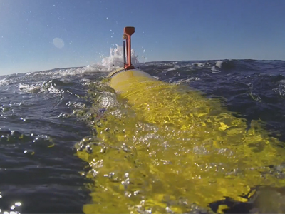
Maritime deployable systems comprises the core science of the LSA group which has over 12 years’ experience in development and evaluation of autonomous underwater vehicles for littoral operations such as mine hunting and rapid environmental assessment. Other expertise includes underwater communications, platform autonomy and interoperability and underwater glider operations.
Mine Countermeasures Systems
The Mine Countermeasures (MCM) Systems Group can trace its origins directly back to the Mine Warfare Group at RANEL, which was established in 1970 to assist Defence and the First Australian Mine Countermeasures Squadron and clearance diving teams. The primary role of MCM systems is to support the RAN’s mine warfare capability by providing advice on existing naval mine threats and reducing the fleet’s vulnerability to mine attack. Generally, this is achieved by measuring underwater influences (e.g., acoustic and magnetic) and modelling how they propagate underwater and are used by mines to identify targets.
MCM Systems also applies these results towards developing countermeasures like signature management and minesweeping. An example of this is the AMAS system. MCM Systems maintains an ongoing industry alliance with Thales, supporting capability development through design, validation and verification of new minesweeping capabilities. The MCM Systems Group is interested in collaborative research and development on:
- Autonomous MCM capability – how unmanned systems can be used to “remove the man from the minefield” but “keep the operator on the loop” (of mine warfare decision making)
- Counter-MCM – for example, how mines might attack unmanned systems (e.g., by targeting minehunting sonar) or use stealth to avoid detection
- AI and Machine Learning and how these and other advanced algorithms may affect mine targeting and signature management
- Environmental Effects – how ambient conditions and traffic noise affect mine targeting and mine countermeasures performance
Littoral Sensing and Processing
The primary role of the Littoral Sensing and Processing (LSP) Group is to support the RAN’s capability for battlespace characterisation and situational awareness of littoral regions to support automated target recognition, humanitarian assistance and disaster relief. This is achieved through core research strengths in remote and intelligent sensing, including:
- Development and testing of miniaturised electro-optic sensors (hyperspectral and lidar) and embedded signal processors for Unmanned Aerial Vehicles (UAVs), Autonomous Underwater Vehicles (AUVs) and satellites
- Advanced data fusion techniques and data analytics such as machine learning to manage large data sets and interpret them into timely and meaningful data products
- Novel data processing for improved sonar classification and identification of objects on the seabed or in the water column.
LSP has nearly 20 years’ experience working with international partners on the development and testing of airborne sensors for electromagnetic characterisation of coastal and estuarine environments. Future work includes development of platform and payload autonomy for adaptive environmental sampling. LSP is also working with the US Office of Naval Research and RoboNation to host the 2022 RobotX Challenge in Sydney AUS.
